CAMINO KOALA
AccommodationGearCommunity
/
Sign up / Log in
/
CAMINO KOALA

Your trusted guide to walking the Camino de Santiago. Plan your stages, find accommodation, and prepare for the journey of a lifetime.

Explore

  • All Routes
  • Camino Francés
  • Camino del Norte
  • Camino Portugués
  • Le Chemin du Puy

Plan

  • Essential Info
  • Gear Guide
  • When to Go
  • Budget Planning
  • Frequently Asked Questions

Community

  • Pilgrim Stories
  • About Us
  • Contact
Built with by pilgrims, for pilgrims
Privacy PolicyTerms of ServiceAffiliate Disclosure
© 2026 Camino Koala
  1. Home
  2. Le Chemin du Puy
Full Guide Available

Le Chemin du Puy

The Way of Le Puy or Via Podiensis

The most popular Camino route in France. Follow the ancient GR65 through volcanic plateaus, medieval villages, and rolling countryside to the Pyrenees, where it joins the Camino Francés.

751 km
29 Stages
27-31 days
Moderate
Best: May - Jun, Sep

About the Le Chemin du Puy

Essential Reading

Which Camino Route Should I Choose? A Complete Guide for Every Pilgrim
Browse all guides

Route Highlights

✦Walk the most popular Camino route in France
✦UNESCO World Heritage pilgrimage path (GR65)
✦Cross the volcanic highlands of the Velay and the wild Aubrac plateau
✦Visit Conques, one of France's most beautiful medieval villages
✦Experience authentic French gîte hospitality and communal table d'hôte dinners
✦Connects directly with the Camino Francés at Saint-Jean-Pied-de-Port

Le Chemin du Puy, also known as the Via Podiensis, is the most popular Camino de Santiago route in France and one of the most beautiful long-distance walks in Europe. Starting from the dramatic volcanic city of Le Puy-en-Velay, the route crosses 736 km of southern France before arriving at Saint-Jean-Pied-de-Port in the Pyrenees, where it connects with the Camino Frances for the onward journey to Santiago de Compostela.

This is one of the oldest pilgrimage routes to Santiago. In 951 AD, Bishop Godescalc of Le Puy set out with a large retinue to visit the tomb of Saint James, becoming one of the earliest documented pilgrims. The route was later featured in the 12th-century Codex Calixtinus, the first pilgrim guidebook, as one of the four great French routes to Santiago. The path is now waymarked as the GR65, one of France's official long-distance hiking trails, and is recognised as a UNESCO World Heritage route.

The landscape is extraordinarily varied. The route begins in the volcanic highlands of the Velay, with views of ancient lava peaks and the astonishing chapel of Saint-Michel d'Aiguilhe perched on a volcanic needle. It crosses the wild Aubrac plateau, a vast treeless highland of cattle pastures and stone-built villages. It descends into the Lot Valley, passes through the medieval jewel of Conques with its Romanesque abbey, and continues through the limestone gorges of the Quercy, the rolling green hills of Gascony, the vineyards of Armagnac, and finally the Basque Country before reaching the Pyrenees.

The route is rated moderate. There are no extreme mountain crossings but the terrain is constantly undulating with frequent ascents and descents, particularly in the first week through the volcanic hills and on the Aubrac plateau. Daily stages average 20 to 25 km. The route is well-marked, well-served by gites (French pilgrim hostels), chambres d'hotes (guesthouses), and small hotels. Meals are often communal table d'hote dinners featuring local specialities, which are a highlight of the experience.

Unlike the Spanish Camino routes, Le Chemin du Puy passes almost entirely through rural France. Towns are small, the pace is slow, and the pilgrim community is predominantly French. English is less widely spoken in the smaller villages, which adds to the immersion. The route is best walked between mid-April and mid-October.

This route is ideal for pilgrims who want to experience the French side of the Camino, those planning to walk the full route from Le Puy to Santiago (approximately 1,500 km over 8 to 10 weeks), and anyone drawn to French countryside, history, food, and culture.
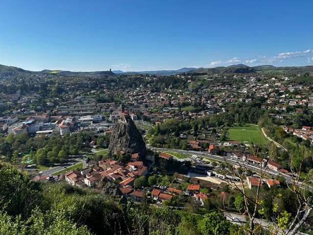
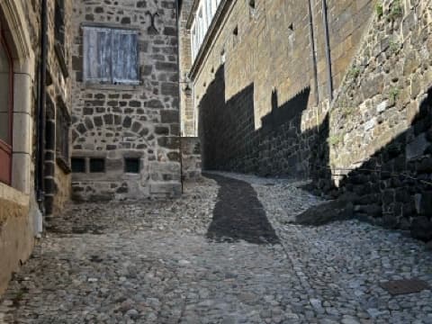
Route photo
Route photo 2
Route photo 3
Route photo 4
Route photo 5
Route photo 1
Route photo 2
Route photo 3
Route photo 4
Route photo 5

Elevation Profile

Adjust Your Starting Point

Le Puy-en-Velay → Saint Jean Pied de Port

29 stages · 751km to Saint Jean Pied de Port

Full French route. Volcanic Auvergne, the Aubrac plateau, Conques abbey, Pyrenean foothills. French food and wine throughout.

0
Arrive In Le Puy-en-Velay
Rest, prepare and collect your credential
🌋 Haute-Loire / Velay
1
Le Puy-en-Velay→Saint-Privat-d'Allier
↑ 867m ↓ 654m·6-9 hours

UNESCO World Heritage - Daily pilgrim mass at 7am in the cathedral.

23.5 km
2
Saint-Privat-d'Allier→Saugues
↑ 1302m ↓ 1229m·6-9 hours
19.5 km
3
Saugues→Saint-Alban-sur-Limagnole
↑ 1046m ↓ 1050m·9-12 hours
32.5 km
4
Saint-Alban-sur-Limagnole→Aumont-Aubrac
↑ 578m ↓ 475m·4-5 hours
15.5 km
🐄 Aubrac Plateau
5
Aumont-Aubrac→Nasbinals
↑ 693m ↓ 557m·6-9 hours
26 km
6
Nasbinals→Saint-Chély-d'Aubrac
↑ 622m ↓ 1000m·5-6 hours
16.5 km
7
Saint-Chély-d'Aubrac→Espalion
↑ 1124m ↓ 1591m·7-10 hours
24 km
8
Espalion→Golinhac
↑ 1484m ↓ 1191m·8-11 hours
26.5 km
9
Golinhac→Conques
↑ 1247m ↓ 1594m·7-10 hours

Les Plus Beaux Villages - Romanesque abbey and UNESCO World Heritage site.

23 km
10
Conques→Livinhac-le-Haut
↑ 1464m ↓ 1553m·8-11 hours
26 km
11
Livinhac-le-Haut→Figeac
↑ 724m ↓ 729m·6-9 hours
24 km
12
Figeac→Cajarc
↑ 815m ↓ 855m·7-10 hours
29.5 km
13
Cajarc→Limogne-en-Quercy
↑ 594m ↓ 444m·4-7 hours
19.5 km
14
Limogne-en-Quercy→Cahors
↑ 638m ↓ 824m·10-13 hours
39.5 km
15
Cahors→Lascabanes
↑ 616m ↓ 551m·6-9 hours
24.5 km
16
Lascabanes→Lauzerte
↑ 838m ↓ 793m·6-9 hours
24.5 km
17
Lauzerte→Moissac
↑ 914m ↓ 1066m·7-10 hours
27.5 km
18
Moissac→Auvillar
↑ 544m ↓ 503m·5-8 hours
22 km
19
Auvillar→Lectoure
↑ 898m ↓ 834m·8-11 hours
32.5 km
🍇 Gascony / Gers
20
Lectoure→Condom
↑ 715m ↓ 814m·8-11 hours
31 km
21
Condom→Éauze
↑ 726m ↓ 644m·8-11 hours
33.5 km
22
Éauze→Nogaro
↑ 328m ↓ 390m·4-7 hours
20.5 km
23
Nogaro→Aire-sur-l'Adour
↑ 363m ↓ 381m·6-9 hours
28 km
🏔️ Béarn / Basque Country
24
Aire-sur-l'Adour→Arzacq-Arraziguet
↑ 683m ↓ 534m·8-11 hours
33.5 km
25
Arzacq-Arraziguet→Arthez-de-Béarn
↑ 636m ↓ 671m·7-10 hours
30 km
26
Arthez-de-Béarn→Navarrenx
↑ 628m ↓ 696m·8-11 hours
31.5 km
27
Navarrenx→Saint-Palais
↑ 913m ↓ 899m·9-12 hours
36 km
28
Saint-Palais→Ostabat-Asme
↑ 340m ↓ 331m·1-2 hours
6.9 km
29
Ostabat-Asme→Saint Jean Pied de Port
↑ 846m ↓ 818m·6-9 hours
22 km

Click any stage to see full details, maps, towns, and accommodation.