CAMINO KOALA
AccommodationGearCommunity
/
Sign up / Log in
/
CAMINO KOALA

Your trusted guide to walking the Camino de Santiago. Plan your stages, find accommodation, and prepare for the journey of a lifetime.

Explore

  • All Routes
  • Camino Francés
  • Camino del Norte
  • Camino Portugués
  • Le Chemin du Puy

Plan

  • Essential Info
  • Gear Guide
  • When to Go
  • Budget Planning
  • Frequently Asked Questions

Community

  • Pilgrim Stories
  • About Us
  • Contact
Built with by pilgrims, for pilgrims
Privacy PolicyTerms of ServiceAffiliate Disclosure
© 2026 Camino Koala
  1. Home
  2. Camino del Norte
Full Guide Available

Camino del Norte

The Northern Way

The stunning coastal route along Spain's northern shoreline through the Basque Country, Cantabria, and Asturias.

836 km
35 Stages
33-37 days
Expert
Best: May - Jun, Sep

About the Camino del Norte

Essential Reading

What is the Camino de Santiago?Camino de Santiago for Beginners: Everything You Need to KnowWhich Camino Route Should I Choose? A Complete Guide for Every Pilgrim
Browse all guides

Route Highlights

✦Dramatic Atlantic coastline views
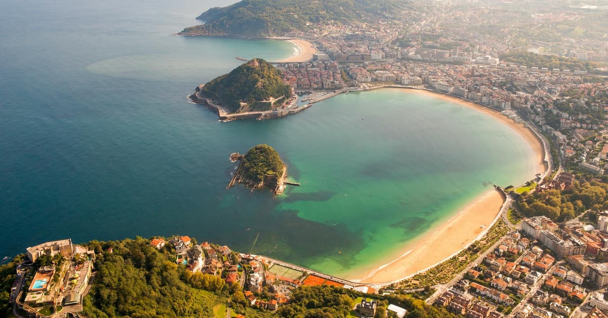
✦Vibrant Basque cities: San Sebastián, Bilbao
✦Fresh seafood and pintxos culture
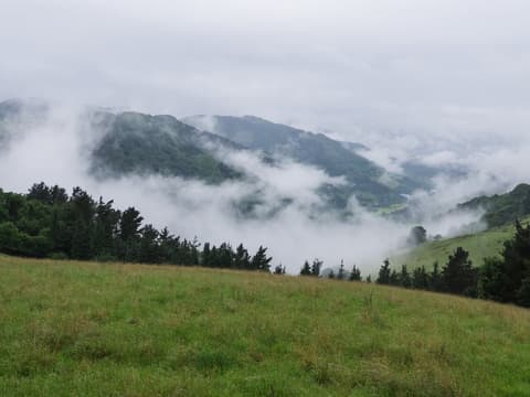
✦Green, mountainous landscapes
✦Less crowded than the Francés

The Camino del Norte follows Spain's rugged northern coastline from Irún, on the French border, to Santiago de Compostela. At 825 km, it is the second longest Camino route and one of the most scenic, tracing the Cantabrian Sea through four distinct regions: the Basque Country, Cantabria, Asturias, and Galicia.

This was one of the earliest routes to Santiago. During the 9th and 10th centuries, when much of central and southern Spain was under Moorish control, pilgrims from across Europe landed at northern ports and followed the coast westward. The route fell out of favour once the Camino Francés became safer after the Reconquista, but has seen a strong revival in recent decades.

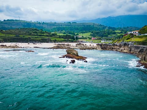
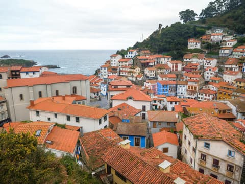
The landscape shifts constantly. The Basque Country delivers steep coastal cliffs and world-class pintxos in San Sebastián. Cantabria offers golden beaches, the medieval gem of Santillana del Mar, and the dramatic descent into Santander. Asturias brings cider country, remote mountain paths, and tiny fishing villages. Galicia turns inland through eucalyptus forests and quiet hamlets before joining the Camino Francés at Arzúa for the final two stages to Santiago.

The Norte is considered one of the more challenging routes. The terrain is hilly throughout, with constant ascents and descents, particularly in the Basque Country and Asturias. Daily stages average 23–25 km but several exceed 30 km. The coastal climate means mild summers but frequent rain, especially in Galicia. Accommodation is available throughout but less dense than on the Francés, so booking ahead is recommended in beach towns during July and August.

This route is best suited for experienced walkers who want dramatic scenery, fewer crowds, and outstanding food. It takes 30–35 days to complete and is best walked between May and October. Pilgrims can also detour from Gijón or Villaviciosa to Oviedo to join the Camino Primitivo, combining two routes into one journey.
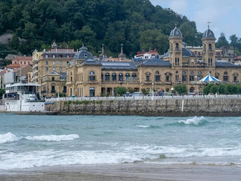
Route photo
Route photo 2
Route photo 3
Route photo 4
Route photo 5
Route photo 1
Route photo 2
Route photo 3
Route photo 4
Route photo 5

Elevation Profile

Adjust Your Starting Point

Irun → Santiago de Compostela

35 stages · 836km to Santiago de Compostela

Full route. The spectacular Cantabrian coast from the French border to Santiago. The most scenic Camino with the best food.

0
Arrive In Irun
Rest, prepare and collect your credential
Basque Country
1
Irun→San Sebastián (Donostia)
↑ 2562m ↓ 2561m·9-12 hours
25 km
2
San Sebastián (Donostia)→Zarautz
↑ 1428m ↓ 1430m·7-10 hours
22.5 km
3
Zarautz→Deba
↑ 1447m ↓ 1444m·7-10 hours
22 km
4
Deba→Markina-Xemein
↑ 2013m ↓ 1941m·8-11 hours
23.5 km
5
Markina-Xemein→Gernika Lumo
↑ 1399m ↓ 1475m·7-10 hours
25.5 km
6
Gernika Lumo→Lezama
↑ 849m ↓ 800m·5-8 hours
20 km
7
Lezama→Bilbao
↑ 536m ↓ 561m·3-4 hours
12.5 km
Cantabria
8
Bilbao→Portugalete
↑ 961m ↓ 939m·5-8 hours
18.5 km
Portugalete to Castro Urdiales
9
Portugalete→Castro-Urdiales
↑ 1287m ↓ 1331m·7-10 hours
25.5 km
10
Castro-Urdiales→Laredo
↑ 1367m ↓ 1381m·9-12 hours
32.5 km
11
Laredo→Güemes
↑ 630m ↓ 559m·7-10 hours
29 km
12
Güemes→Santander
↑ 465m ↓ 518m·4-7 hours
20 km
13
Santander→Santillana del Mar
↑ 872m ↓ 803m·10-13 hours
38 km
14
Santillana del Mar→Comillas
↑ 636m ↓ 690m·5-8 hours
21 km
15
Comillas→Colombres
↑ 1107m ↓ 1035m·8-11 hours
29 km
Asturias
16
Colombres→Llanes
↑ 785m ↓ 888m·6-9 hours
25.5 km
17
Llanes→Ribadesella / Ribeseya
↑ 993m ↓ 983m·8-11 hours
30 km
18
Ribadesella / Ribeseya→Colunga
↑ 785m ↓ 795m·5-8 hours
21.5 km
19
Colunga→Villaviciosa
↑ 635m ↓ 637m·5-6 hours
18 km
20
Villaviciosa→Gijón / Xixón
↑ 1348m ↓ 1343m·9-12 hours
30 km
21
Gijón / Xixón→Avilés
↑ 683m ↓ 678m·6-9 hours
26 km
22
Avilés→Muros de Nalón
↑ 898m ↓ 785m·5-8 hours
21 km
23
Muros de Nalón→Soto de Luiña
↑ 948m ↓ 1061m·5-6 hours
15.5 km
24
Soto de Luiña→Cadavéu (Cadavedo)
↑ 1190m ↓ 1119m·5-8 hours
18 km
25
Cadavéu (Cadavedo)→Luarca / Ḷḷuarca
↑ 479m ↓ 562m·4-5 hours
16.5 km
26
Luarca / Ḷḷuarca→A Caridá
↑ 884m ↓ 825m·8-11 hours
30.5 km
Galicia
27
A Caridá→Ribadeo
↑ 360m ↓ 384m·5-8 hours
24 km
28
Ribadeo→Lourenza
↑ 1440m ↓ 1428m·8-11 hours
27 km
29
Lourenza→Abadín
↑ 1978m ↓ 1524m·9-12 hours
27.5 km
30
Abadín→Vilalba
↑ 353m ↓ 384m·4-7 hours
20.5 km
31
Vilalba→Baamonde
↑ 361m ↓ 434m·5-6 hours
19 km
32
Baamonde→Sobrado dos Monxes
↑ 909m ↓ 802m·10-14 hours
40 km
33
Sobrado dos Monxes→Arzúa
↑ 406m ↓ 532m·5-8 hours
22 km
34
Arzúa→O Pedrouzo
↑ 514m ↓ 607m·4-7 hours
19 km
35
O Pedrouzo→Santiago de Compostela
↑ 481m ↓ 534m·4-7 hours

Final stage - Praza do Obradoiro - Collect Compostela at Pilgrim Office

19.5 km

Click any stage to see full details, maps, towns, and accommodation.